


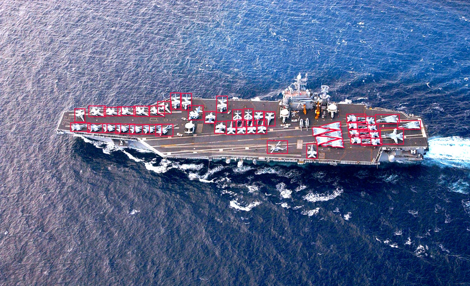
Military Surveillance
Military surveillance are now done using advanced AI powered UAVs
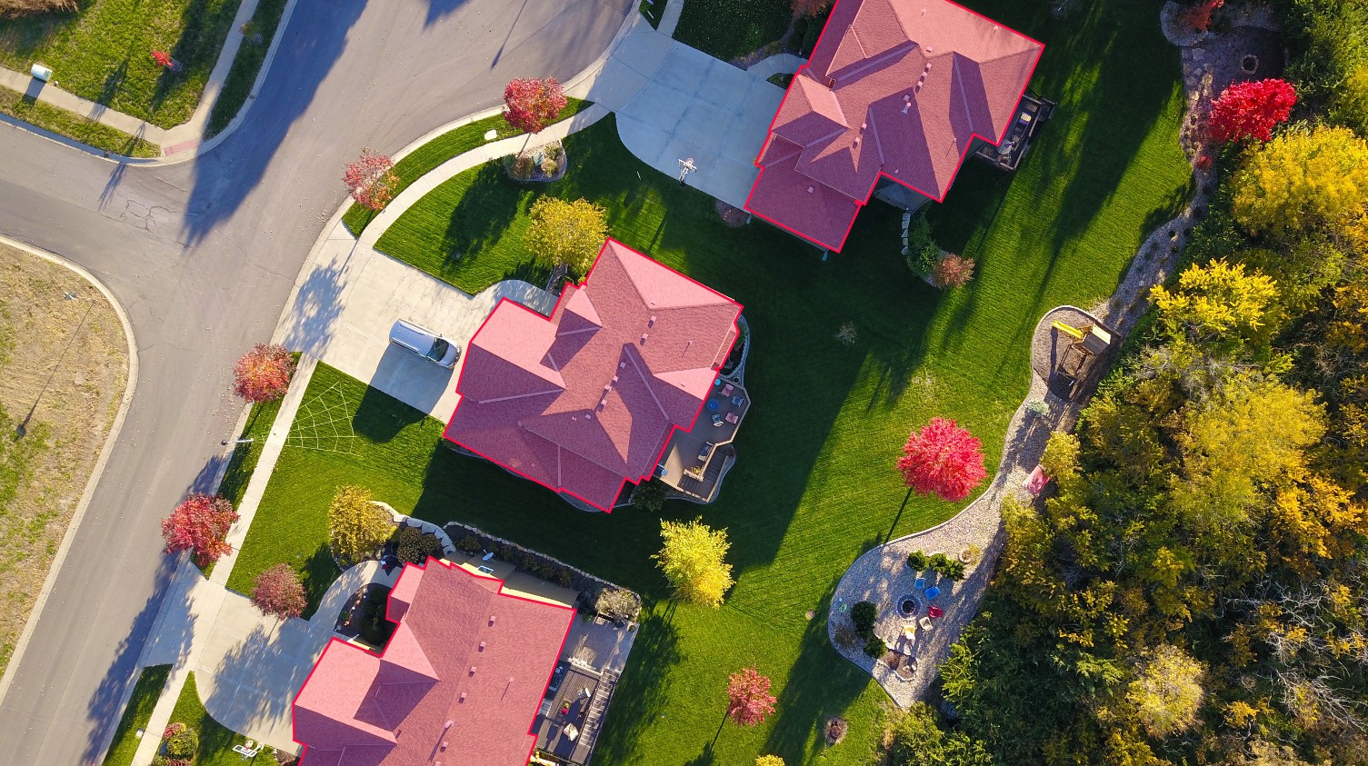
Roof Top Analysis
Aerial Imagery of roof tops are used to analyze and create different type of computer vision models . Some of our expertise area are :
- Material type analysis
- Inclination analysis
- Direction analysis
- Solar panel detection
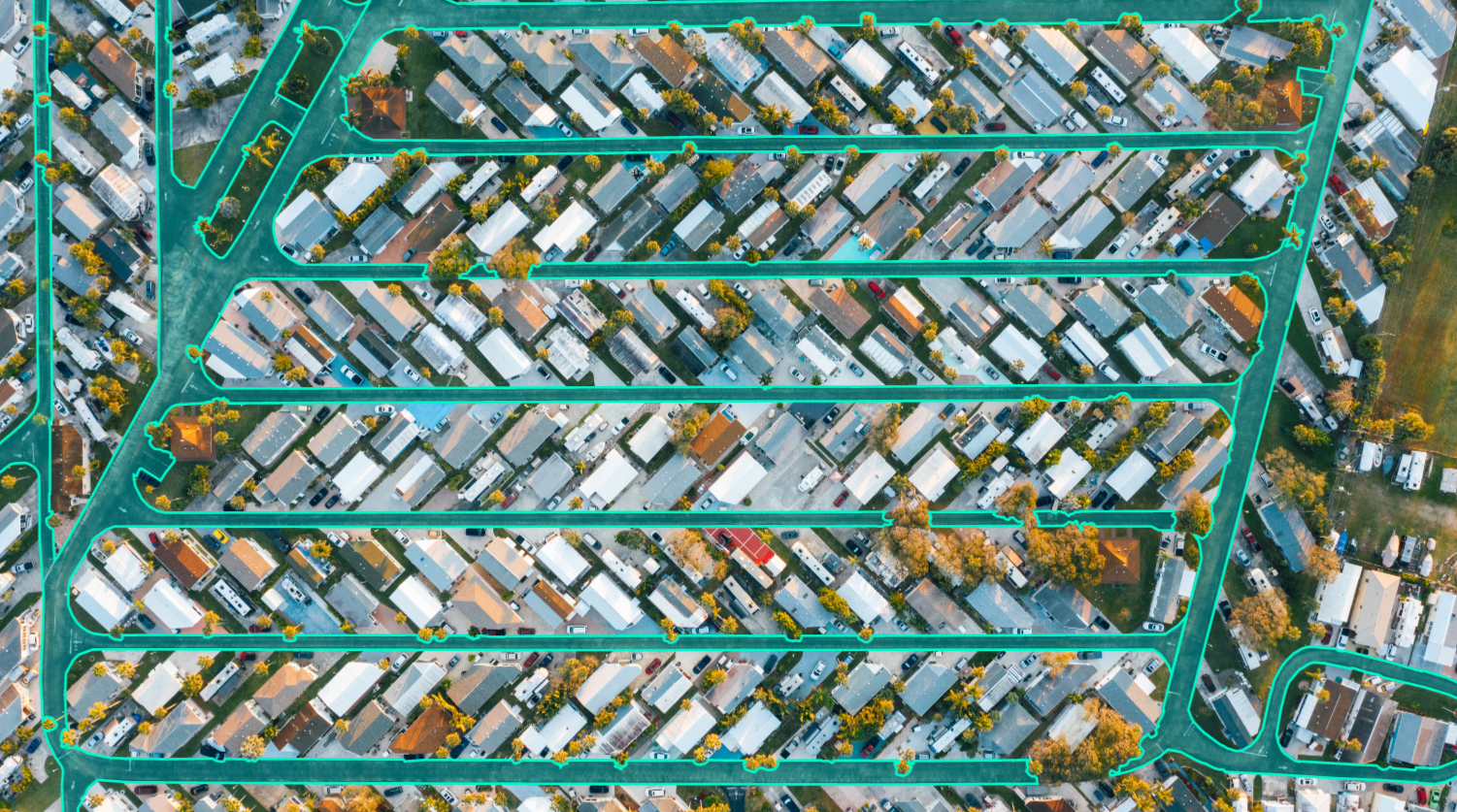
Geo-Spatial Analysis
We analyse and annotate satelite images of towns,cities and forest and annotate roads,buildings,trees etc , for various applications of Computer Vision models
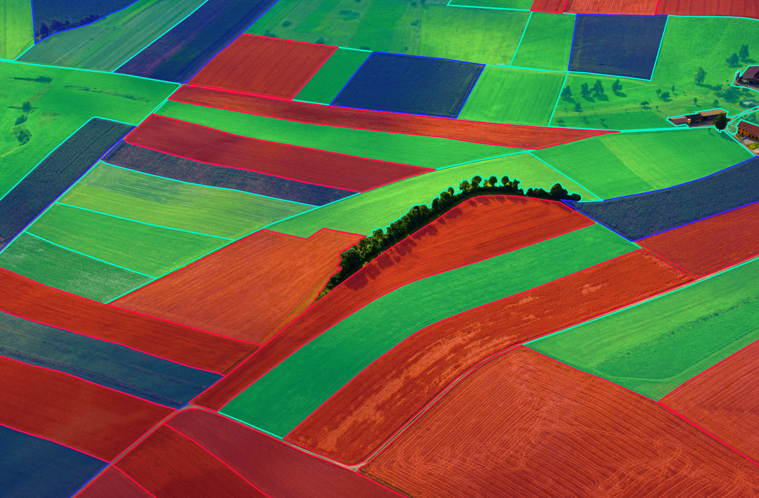
Field Analysis
Aerial Images of crop fields are annotated for AI powered Crop Health Monitoring systems
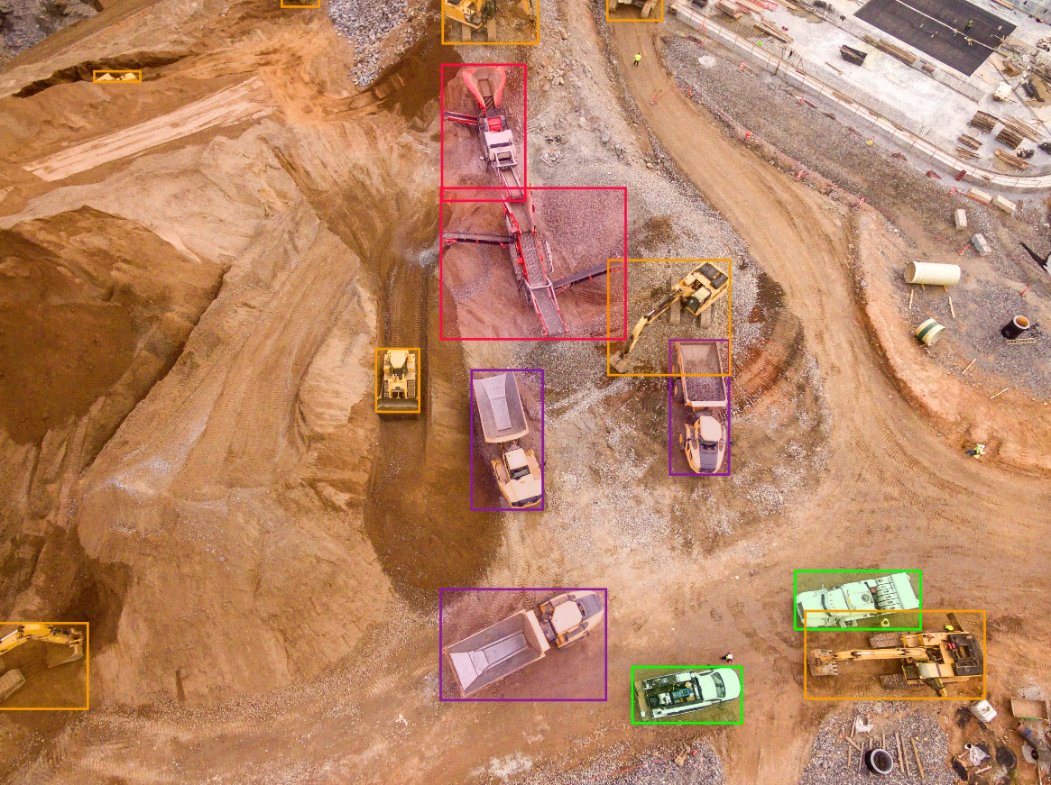
Industrial Inspection & Montoring System
Drones are used to monitor and inspect large construction sites using AI which is ten times more efficient than human inspectors
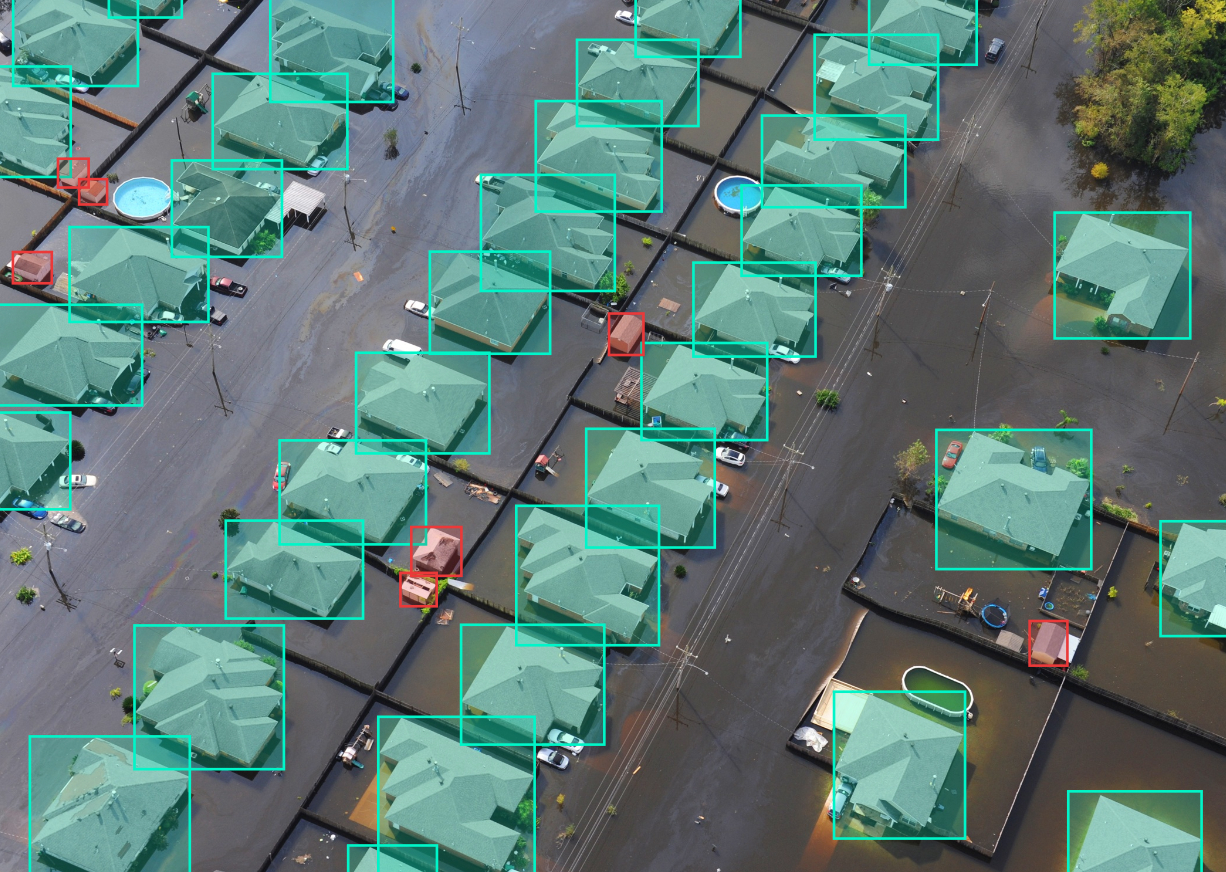
Disaster Management System
AI powered drone are implemented during the times of disasters to :
- Analyse the impact of disasters
- Find & Rescue people and animals
- Natural Disaster prediction System
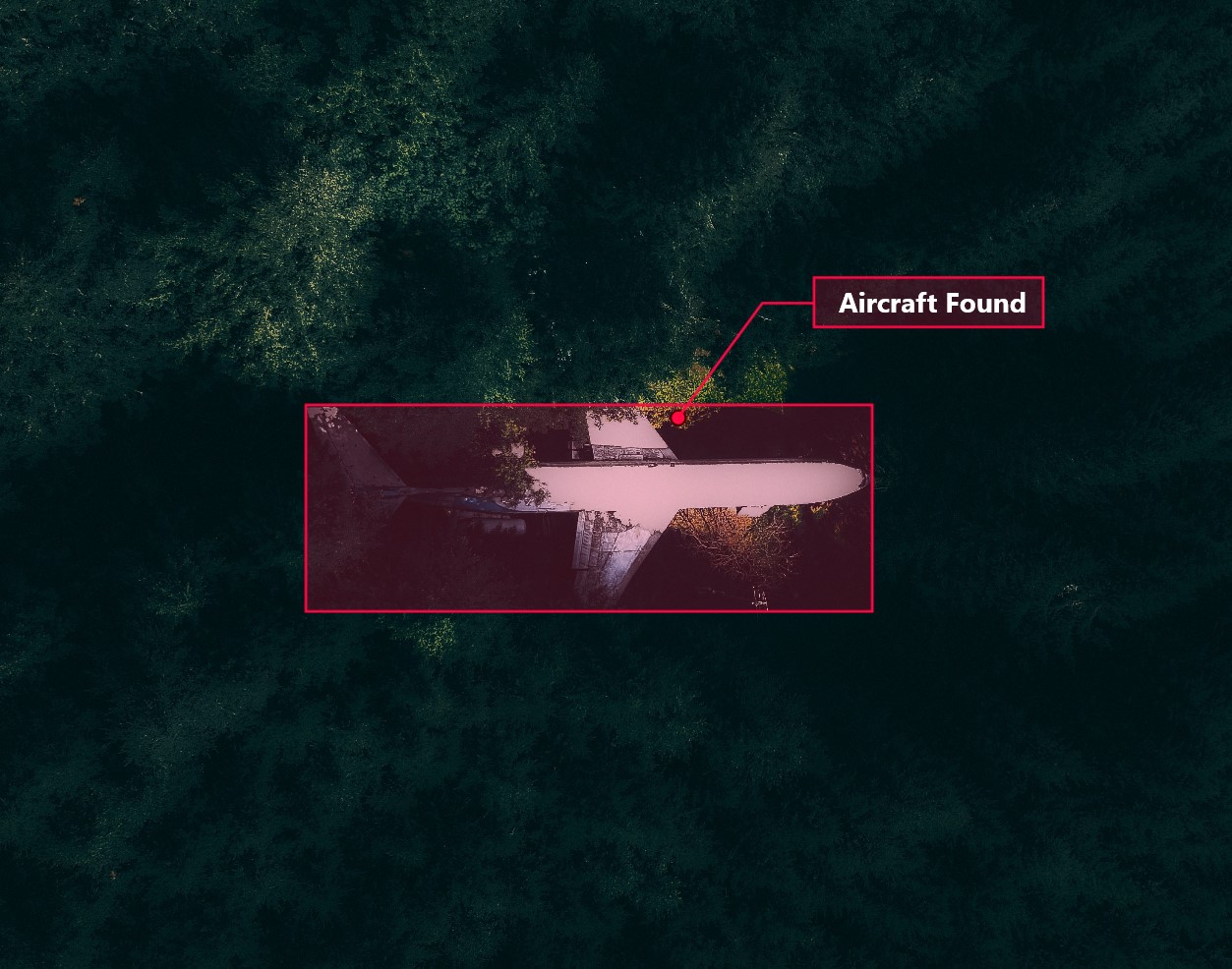
Search & Rescue
Drones are used to find crashed aircrafts in the middle of sea and forest